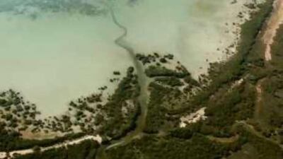
ABU DHABI // Developers who damage the environment will no longer be able to plead a lack of information following yesterday's launch of an interactive online guide to the emirate's coastal and marine resources. The Coastal Resources Atlas and Vulnerability Index, which includes detailed maps of ecologically sensitive areas as well as the habitats of key endangered marine species, was created by the Environment Agency-Abu Dhabi (EAD) to assist coastal planning and development decisions.
"The atlas will help developers in providing the data they need to plan and execute their projects," said Majid al Mansouri, the EAD's secretary general. The result of two years' work, the atlas is the first comprehensive resource of its kind in the Gulf region. "Abu Dhabi's coastal and marine environment is very rich and diverse, but it is facing challenges," said Dr Thabit Zahran al Abdessalaam, EAD's director of biodiversity sector.
Fishing, dredging, port development, tourism and recreational activities all take a toll on the marine environment. A lack of baseline scientific data has made it difficult to assess the environmental impact of new developments, a situation worsened by the fast-pace of Abu Dhabi's growth. Dr al Abdessalaam said this was now changing. "Developers cannot come to us and tell us they do not have the information," he said.
A developer planning to dredge along the coastline will be able to map out areas containing high levels of sedimentation and overlay these areas with ecological data. Besides being able to zoom in on the ecological aspects of an area, the coastal atlas provides information about infrastructure, economic activities and cultural sites, as well as water quality information. The atlas evaluates the vulnerability of different areas along the coastline against 15 different stressors such as chemical pollution, sea level rise, over-exploitation of resources and thermal discharges. It also provides valuable information about the impact of spilled oil, of particular interest considering the situation on the US Gulf Coast.
Dr al Abdessalaam said some oil products would settle on the aerial roots of mangroves, effectively suffocating them. Heavy oil would generally sink with most damage done to coral reefs and sea grass beds. "The oil spill vulnerability assessment helps to define sensitive areas that could be affected by oil and prioritise which areas need to be protected," he said. The tool contains five scenarios, showing hypothetical oil spills and the resulting damage.
The software has also been designed to be used as a central near-real-time resource point in the event of a genuine oil spill, showing the tracking of the oil's movements and helping to ensure crucial information is exchanged transparently and smoothly between the organisations involved in the spill's management. The English version can be found at coastalatlas.ead.ae/English @Email:vtodorova@thenational.ae

