

Today, life in the Emirates moves in the fast lane. In a regular series to mark the 50th anniversary of the UAE, we take a trip back in time to see how much the country has changed.
When Dubai’s World Trade Centre opened in 1979, it was considered way out of a town then centred around the Creek. But development of the city in the following years would extend far beyond the Trade Centre south towards Abu Dhabi and into the Arabian Gulf through huge land reclamation projects.
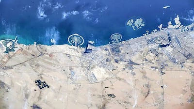
This series has used old photographs to map the changes across the UAE over the past five decades but this week it is the turn of satellite imagery.
Data from the Google Earth Timelapse project shows just how Dubai’s coast has been reshaped by these mammoth projects in just a few decades.
-
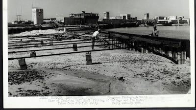
Major development work on the coast started on Dubai Creek in the late 1950s with the construction of anti-flooding barriers. Photo: Arabian Gulf Digital Archive -
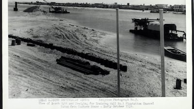
The work also involved dredging to allow large boats to enter. Photo: Arabian Gulf Digital Archive -
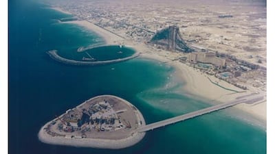
Land reclamation was to be a major part of the Dubai story. The artificial island that Burj Al Arab would sit on was complete and construction on the hotel well advanced by 1996. -

A larger reclamation project then got under way nearby. Dredging for Palm Jumeirah was in full swing by 2002, with Burj Al Arab and Jumeirah beach hotels in the background. AFP -

Fronds of Palm Jumeirah emerged by November 2003. AFP -
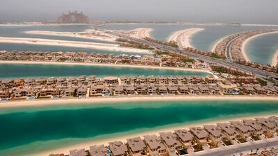
Construction work continued at a fast pace on Palm Jumeirah with villas built by 2008. Reuters -
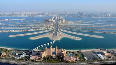
Dubai's Palm Jumeirah today is a famous part of the emirate's coast. Reuters -

The Palm Jebel Ali, which is waiting to be developed, as seen in the 2000s. Reuters -
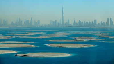
Another one of Dubai's land reclamation projects is The World Islands. Sarah Dea / The National -
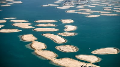
The World Islands, an archipelago of tiny artificial islands in the shape of the world, as seen in July 2020. AFP -
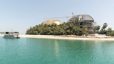
Sweden Island on The World Islands. Developers behind The Heart of Europe are reportedly planning to open the first phase of the six-island projects. Antonie Robertson / The National -
Dubai's changing coastline: from Palm Jumeirah to The World Islands. Photo: Dubai Media Office


The time-lapse, a zoomable picture of how the Earth's surface has changed, starts in 1984 and the most striking alterations to the coast seen here are Jebel Ali Port, close to the border with Abu Dhabi, and the earlier Port Rashid beside the Creek. By the late 1980s we can see the emergence of Emirates Golf Club. It becomes a sea of green surrounded by desert close to the coast.
Construction then ramps up and, by 1996, the emergence of the man-made island that would host Burj Al Arab emerges. The hotel opened in 1999. Construction of Dubai Marina can also be identified.
In 2001, we see the faint lines of Dubai’s first huge reclamation project — Palm Jumeirah — with the fronds and crescent clearly visible. As the 2000s progressed, The Palm Jebel Ali and then The World Islands — an archipelago of small artificial islands constructed in the shape of a map — rise from the waters. Both projects were stalled after the global 2008 financial crisis but activity on The World has ramped up recently, while Palm Jebel Ali developer Nakheel has previously said it remains committed to the project.

The time-lapse also shows the start of construction on another palm project — Palm Deira — but this was rebranded Deira Islands by Nakheel in 2013.
The time-lapse ends in 2020 but also shows the newer coastal projects that will set Dubai on a course of growth for the future. Dubai Canal — which joined the Creek with Business Bay — was completed by 2016, while by 2020, attention turned back to Dubai Creek.
But this time the development is farther inland at Dubai Creek Harbour. When complete, the luxury development of waterfront apartments aims to house 200,000 people.