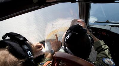
PERTH // The search area for the lost Malaysian jetliner has moved 1,100 kilometres to the north-east, following a new analysis of radar data, and a search aircraft quickly found objects that a ship set out to investigate.
Five out of 10 aircraft hunting for Malaysia Airlines Flight 370 found objects of various colours Friday, the Australian Maritime Safety Authority said. It said it was not clear whether the objects were from the plane, and photos of them would be analysed overnight.
AMSA said the items included two rectangular objects that were blue and grey — among the colours of the missing plane. A Chinese patrol ship in the area will attempt to locate the objects on Saturday, it said.
Australian officials said they turned away from the old search area, which they had combed for a week, because a new analysis of radar data suggests the plane had flown faster and therefore ran out of fuel more quickly than previously estimated. The new area is closer to land and has calmer weather than the old one, which will make searching easier.
"We have moved on" from the old search area, said John Young, manager of Amsa's emergency response division.
The radar data that was analysed again was received soon after Flight 370 lost communications and veered from its scheduled path on March 8. The Beijing-bound flight carrying 239 people turned around soon after taking off from Kuala Lumpur, flew west towards the Malacca Strait and disappeared from radar.
The search area has changed several times since the plane vanished as experts analysed a frustratingly small amount of data from the aircraft, including the radar signals and "pings" that a satellite picked up for several hours after radar contact was lost.
The latest analysis indicated the aircraft was travelling faster than previously estimated, resulting in increased fuel use and reducing the possible distance the aircraft could have flown before going down in the Indian Ocean. Just as a car loses gas efficiency when driving at high speeds, a plane will get less out of a tank of fuel when it flies faster.
Malaysia's civil aviation chief, Azharuddin Abdul Rahman, said in Kuala Lumpur that analysts at Boeing in Seattle had helped with the analysis of the flight.
Planes and ships had spent a week searching about 2,500 kilometres south-west of Perth, Australia, the base for the search. Now they are searching about 1,850 kilometres west of the city.
"This is our best estimate of the area in which the aircraft is likely to have crashed into the ocean," Martin Dolan, chief commissioner of the Australian Transport Safety Bureau, said in Canberra.
He said a wide range of scenarios went into the calculation. "We're looking at the data from the so-called pinging of the satellite, the polling of the satellites, and that gives a distance from a satellite to the aircraft to within a reasonable approximation," he said. He said that information was coupled with various projections of aircraft performance and the plane's distance from the satellites at given times.
Mr Dolan said the search now is for surface debris to give an indication of "where the main aircraft wreckage is likely to be. This has a long way to go."
Objects in the new search area were seen from a New Zealand air force plane, Amsa tweeted, adding that the find needed to be confirmed by ship.
Mr Young indicated that the hundreds of floating objects detected over the past week by satellites, previously considered possible wreckage, were not from the plane after all.
"In regards to the old areas, we have not seen any debris and I would not wish to classify any of the satellite imagery as debris, nor would I want to classify any of the few visual sightings that we made as debris. That's just not justifiable from what we have seen," he said.
In Malaysia, defence minister Hishammuddin Hussein said that because of ocean drifts, "this new search area could still be consistent with the potential objects identified by various satellite images over the past week".
The new search area is about 80 per cent smaller than the old one, but it remains large: about 319,000 square kilometres, about the size of Poland.
Sea depths in the new area range from 2,000 metres to 4,000 metres, Mr Young said.
* Associated Press

Search aircraft find ‘blue and grey objects’ as Flight 370 hunt shifts north
Australian officials said the items included two rectangular objects that were blue and grey – among the colors of the plane that has been missing since March 8.
Most popular today
