
An earthquake of 6.3 magnitude struck the island of Samar in the central Philippines on Tuesday, the US Geological Survey said, a day after a deadly tremor rocked the north and Manila.
The USGS said the earthquake was centred about 13 kilometres east of Tutubigan on Samar. The earthquake was relatively deep at 70.2km.
Authorities warned residents that they should expect aftershocks.
There were no immediate reports of casualties or damage.
Tuesday's earthquake comes a day after a 6.1-magnitude tremor rocked the northern Philippines, killing at least 11 people.
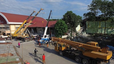
Rescuers in Porac, Pampanga were scrambling to reach dozens of people feared buried under a collapsed market building.
-
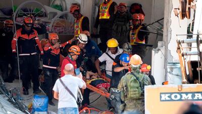
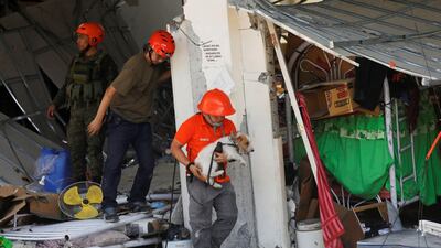
Rescue workers carry a survivor out of the collapsed Chuzon supermarket in Porac, Pampanga. AFP -
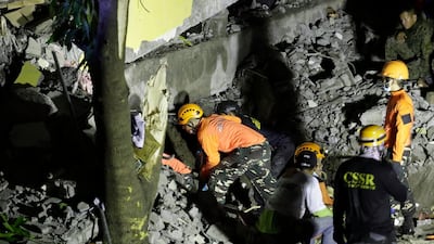
Emergency staff wrok through the night looking for survivors. EPA -
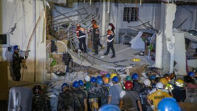
Rescuers search for survivors trapped in the debris. Getty -
Rescuers search for survivors trapped in the debris. Getty -
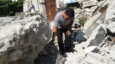
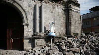
A church worker inspects a bell from the 18th century St. Catherine of Alexandria after its bell tower was destroyed.A FP -
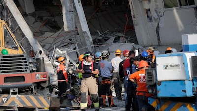
epa07522097 Search operations continue at a collapsed commercial building in Porac town, Pampanga Province, north of Manila, Philippines, 23 April 2019. A 6.1-magnitude earthquake occurred on 22 April in the Philippine region of Luzon with an epicenter located northeast of Zambales province, according to data from the Philippine Institute of Volcanology and Seismology (Phivolcs). According to latest data from the National Disaster Risk Reduction and Management Council (NDRRMC), at least seven people were killed, 81 were hurt and 24 are still missing. EPA/FRANCIS R. MALASIG -
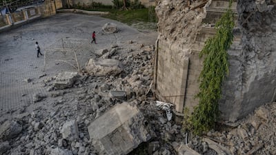
Residents walk past a church that was damaged following a 6.3 magnitude earthquake. Getty Images -
epa07522102 Emergency responders with K-9 dogs join search operations at a collapsed commercial building in Porac town, Pampanga Province, north of Manila, Philippines, 23 April 2019. A 6.1-magnitude earthquake occurred on 22 April in the Philippine region of Luzon with an epicenter located northeast of Zambales province, according to data from the Philippine Institute of Volcanology and Seismology (Phivolcs). According to latest data from the National Disaster Risk Reduction and Management Council (NDRRMC), at least seven people were killed, 81 were hurt and 24 are still missing. EPA/FRANCIS R. MALASIG -
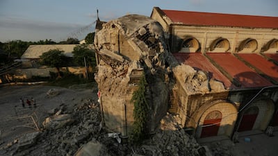
epa07522115 Site of the damaged St. Catherine Parish Church in Porac town, Pampanga Province, north of Manila, Philippines, 23 April 2019. A 6.1-magnitude earthquake occurred on 22 April in the Philippine region of Luzon with an epicenter located northeast of Zambales province, according to data from the Philippine Institute of Volcanology and Seismology (Phivolcs). According to latest data from the National Disaster Risk Reduction and Management Council (NDRRMC), at least seven people were killed, 81 were hurt and 24 are still missing. EPA/FRANCIS R. MALASIG -
Debris and rubble surround the Santa Catalina de Alejandria Parish. Reuters -

Onlookers react as rescuers attempt to reach survivors. Reuters -
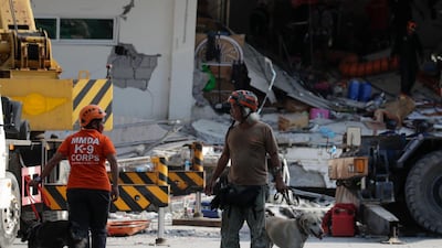
A rescuer carries a search dog as they try to reach survivors. Reuters -
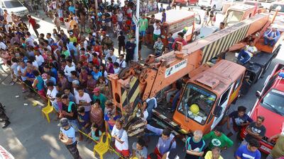
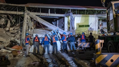
Residents look on as search operations continue at a collapsed commercial building in Porac town. -
Emergency responders at the scene. EPA -
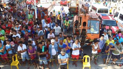
Residents look on as search operations continue at a collapsed commercial building in Porac town. EPA


The quake heavily damaging Clark International Airport and sent terrified office workers in the capital, Manila, fleeing swaying high-rises.
The toll could rise as crews fanned out across the mostly rural region to assess damage in isolated village that lost power and communications.
More than 400 aftershocks have been registered since the initial earthquake, Philippine seismologists said.
The Philippines is part of the Pacific Ring of Fire, an arc of intense seismic activity that stretches from Japan through South East Asia and across the Pacific basin to the United States, Mexico and South America.