ABU DHABI // For obvious reasons, the directions that get you around the city ("Turn left at the cafe, right at the mosque, and we're behind the bakery") are of little use in the desert.
Video: A Bedouin's most prized asset
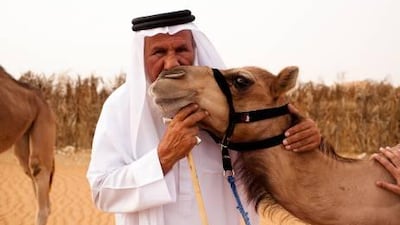
They can carry heavy loads, provide nutrition in the form of milk and meat and can travel for miles with little water in the desert. Any Bedouin would gladly admit Camels are worth more than gold to them in the desert.
For bedouins, the landmarks are on a much grander scale: "Turn towards the rising sun at the mountain, walk for five days and the oasis is by a big rock."
At 84,000 square kilometres, the UAE is one of the world's largest sand deserts, stretching from the Arabian Gulf coast to the Empty Quarter and east to the Hajar Mountains. To navigate its countless intricate dunes, bedouins used a basic technique involving the stars and the sun.
"The sun rises from the east and sets on the west," says Salem Al Kabi, a 60-year-old Emirati who travelled the desert a couple of decades ago. "It helps to guide us during the day, and God made the stars available for us to navigate at night."
Mr Kabi used many different resources to find his way around the desert, including his own expert knowledge gleaned by travelling for years by camel, and the natural environment.
"There is no such thing as left and right," he says. "We tend to stay put during the day when temperatures are too high, and at night the stars guide our track."
When it comes to the stars, Ursa Major - the great bear - directs travellers to Polaris, the northern star.
"Alternatively, if Ursa Major is below the horizon, the constellation Cassiopeia will also point you to Polaris," says Sam McConnell, a desert guide and expedition leader in the Sinai and Jordan.
Instead of compasses, bedouins used sand dunes that were shaped by the wind, which could provide valuable directions.
"Sand dunes form at 90 degrees to the prevailing wind," Mr McConnell says. "So if the prevailing wind is from the east, the dunes will run north to south."
Matar Al Qamzi, a 75-year-old Dubai-based Emirati who has a history of desert navigation, used no specific instruments during his journeys. "We didn't have the money for it, nor the kind of functionality for it," he says, "and to this day, I still use cardinal directions. This is how our people live."
Special report: The Desert Survival Guide
The desert is a tough place to live. For generations, people survived through the UAE's sweltering summers by managing to eke out limited and hidden food, water and shelter. Our reporters look at how they managed it, what they ate - and how those secrets of survival still affect the lives of ordinary Emiratis today.
More from The National on desert survival
The crescent-shaped Barchan dunes form in areas where there is less sand, usually on gravel plains.
"The horns of these will point away from the prevailing wind, so if you know that the wind predominantly comes from the east, the horns will point west," Mr McConnell says.
Dune formation is controlled by a combination of wind strength and direction, and sediment supply. However, the processes involved in the formation of dune patterns is complex and poorly understood.
Ali Manea Alahbabi, a retired Emirati living in Al Ain, used the stars and other landmarks such as large trees, rocks and memorable sand dunes to find his way. But the weather can be challenging, he says.
"For example, the wind makes your footprints disappear from the sand and you lose trace of your tracks.
"It's hard because the sand dunes in the UAE desert are large and the weather makes it even harder - it's very hot during the day and very cold at night."
Summer temperatures can reach 60°C, making the desert a dangerous place for inexperienced travellers.
"The biggest challenge for us was moving sands," says Mr Qamzi, who used to travel by camel to Saudi Arabia for haj.
"There are a lot here, and also many pitfalls that caused a great number of people to die, because it's not something you can predict."
Although astrolabes, the ancient instruments used by astronomers, were developed in the medieval Islamic world and were widely used to establish the direction of Mecca, Mr McConnell has never seen a Bedouin use any instruments to navigate.
"The Bedu don't use any navigational aids as we know them," he says. "No maps - because they are all inside their heads.
"Nowadays, we have Google Earth, GPS, maps and compasses, but being able to orientate yourself using the landscape, the sun, moon and stars, is still vital."

