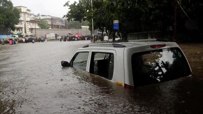
The World Bank launched a new satellites project to quickly assess flood response costs to help expedite relief.
Damages from natural disasters amount to US$300 billion each year, which can place pressure on governments and destabilise countries, the World Bank said. The Washington DC-institution's Disaster Risk Financing and Insurance programme (DRFIP) and Columbia University's Earth Institute joint project aims to define operational framework for the quick evaluation of flood response costs on a national scale.
"Natural disasters can cause fiscal volatility for national governments because of sudden, unexpected expenditures required during and after an event," said the World Bank report authors Antoine Bavandi, Upmanu Lall and Benedikt Signer.
_______________________
Read more:
Disaster Relief: Lessons from the Hurricane Katrina
Maximum-strength Hurricane Maria batters St Croix, heads for Puerto Rico
_______________________
The project, financed by the Rockefeller Foundation, conducted initial demonstration cases in Bangladesh and Thailand. "Of all the different natural hazards, floods seem to be, on average, the type of natural disaster which causes the most damage to life and development gains," said Mr Lall, director of Columbia Water Centre at Columbia University. "What makes this complex and interesting is that there are many variables which go into assessing the loss caused by floods."
The project looked at rainfall-induced riverine floods, which are the most common resulting in expensive damage.
Flooding in Thailand in 2011 caused devastation in the northern region as well as the greater Bangkok metro area. Rainfall was three to 10 times more than the country's historical average and despite numerous dams, the volume of rain led to about $46bn in losses, most of it from property damages to manufacturing plants located near Bangkok.
"At this point, we are trying to evaluate the applicability of remote-sensing data to near real-time flood monitoring," said Mr Bavandi, a DRFIP financial sector specialist who leads this project. "Recent satellite technology can be seen as a potential game-changer in this field, and we are exploring how to best leverage their potential for the benefit of the governments we advise."
He said these preliminary results we've seen are promising and options to combine satellite-based measurements with traditional hydrologic model-based approaches are also being explored. "The longer-term objective is to help developing countries make risk-informed decisions on their disaster relief financing," Mr Bavandi said.

