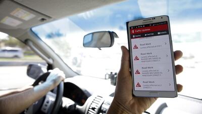
ABU DHABI // A Dh9 million information system that will help motorists to avoid traffic jams, reach their destination quickly and find the nearest parking spot has been launched.
The system will provide real-time information on traffic congestion, route guidance and other conditions via smartphones, the internet and navigation devices in cars.
The integrated transport and navigation system, known as i-Tins, will also provide users of public transport with the locations of bus stations and bus stops, real-time bus schedules, ferry routes and timetables.
“The idea is to reduce traffic congestion levels to 15 to 20 per cent as per international standards and to increase safety,” said Salah Al Marzouqi, director of the Integrated Intelligent Transportation Systems division at the Department of Transport on Wednesday.
“What we have developed is an i-Tins, which integrates applications for all modes of transport into a single dashboard.”
The move is in line with Abu Dhabi's surface transport master plan and Abu Dhabi 2030 vision to be one of the world's top governments and destinations, he said.
"It is part of a road map following the approval of our ITS [intelligent transportation systems] strategy in September 2010," Mr Al Marzouqi said at the launch of the first version of the Darb Mobile application for smartphones, which displays information collated and distributed using i-Tins.
“We designed the system, tendered the contract followed by the deployment, and today, we are launching it.”
The system also offers smart services such as booking a taxi, paying for parking and an option to receive notifications about traffic incidents.
It works through the collection of real-time data from traffic counting systems and taxi and bus GPS information.
“The system-generated data is analysed by our engineers to ensure accuracy, while we also have an operator who monitors road incidents and clarifies and acknowledges that the information is correct,” he said.
“If there is flooding on the road, it is important for us to warn people so they will be extra cautious.”
This system will better inform users about traffic incidents, roadworks and detours through notifications of problems, which will result in improved road safety, said Rashid Al Naqbi, the geographic information systems section head at the department.
“For example, I will be using Maqta Bridge, but I get a notification that there’s an accident there. Users will be guided towards an alternative route which is safer, quicker and easier to take.”
Mr Al Marzouqi said the department expected thousands of residents to download the Darb Mobile app, which is available free on Apple and Android platforms in Arabic and English.
“The UAE has one of the highest levels of smartphone ownership,” he said. “We will keep track of how many are downloading the app and its use, while the customers can provide feedback to enhance it further.”
The DoT is coordinating with navigation-service providers to integrate i-Tins information with the in-car satellite-navigation systems.
“It is good to have mobile apps, but it isn’t the case when one uses them while driving,” Mr Al Marzouqi said of the risks associated with distractions while driving.
“We developed an automated incident report because we do not want users to open and test it, but have this information readily available on their phones so they can focus on their driving.”
rruiz@thenational.ae

