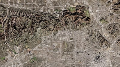
Los Angeles is known for many things – its sunny climate, its standing as the entertainment capital of the world and its Hollywood sign. What the southern Californian city isn't famous for, however, is green space. A look at the city from Google Maps' satellite view, which displays expansive areas of flat, grey concrete, quickly confirms this.
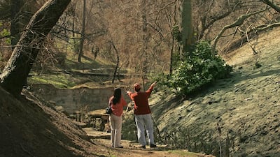
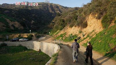
Yet the city is actually home to one of the largest urban parks in North America. In 1896, Colonel J Griffith donated 1,220 hectares of his Rancho Los Feliz estate as a Christmas gift to the people of Los Angeles. Today, Griffith Park consists of 1,626 hectares of mountains, dales and flatlands, situated between Hollywood and the San Fernando Valley.
The city is also home to the 4,452-hectare Topanga State Park, which opened in 1964, and is within touching distance of the Angeles National Forest, which was established in 1908 and spans 265,226 hectares.
However, beyond these specific areas, Los Angeles has one of the lowest percentages of green spaces of any major American urban centre. Almost half of the city’s population doesn’t live within walking distance of a public park (“walking distance” is calculated as a ten-minute walk or less). This is compared with 3 per cent in Boston and 4 per cent in New York.
When you look at a breakdown of residents’ proximity to green spaces, there’s even more bad news. The distance of a person’s home to a green space is almost entirely dependent on their socio-economic status, with 41 per cent of lower-income households in the city not having immediate access to green spaces. Predominately white neighbourhoods, for example, have 12.9 hectares of park space for every 1,000 people, as opposed to African-American neighbourhoods, which only have 0.7 hectares, and Latino neighbourhoods, which have a measly 0.2 hectares.
The situation is even worse for the city’s children, who have only one playground for every 10,000 residents.
Thankfully, there’s hope on the horizon, with numerous initiatives under way that aim to address Los Angeles’ green-spaces problem.
In 2005, Amigos de los Rios, a non-profit organisation committed to designing quality public spaces in urban neighbourhoods, began its efforts on the Emerald Necklace vision. The initiative’s goal was to build 10 green spaces in five cities, all located in Los Angeles County. In 2012, the group joined forces with The Conservation Fund to further its efforts with what was dubbed the Emerald Necklace Forest to Ocean Expanded Vision Plan. The agenda looked to provide a pathway for residents to connect with park and recreation lands, to improve the overall health of residents and the environment.
Plans were completed in 2014, and included an integrated system of pedestrian-priority street segments, bikeways and scenic highways, all specifically for the city of Los Angeles. A reliable network of bikeways, pedestrian paths, repurposed schoolyards and educational campuses was also created along the Los Angeles River. These developments yielded what The Conservation Fund called “long-term benefits”, such as a safer place for children to play, cleaner air and water, and better resilience to climate change.
As part of larger, continuing efforts, groups such as LA Open Acres are looking at the city’s many vacant, blighted and abandoned spaces as opportunities to build vibrant parks, playgrounds and affordable housing.
LA Open Acres is a community-based health education and policy organisation dedicated to promoting social justice, and has lofty goals for the future. The group aims to ensure that every resident in the Los Angeles area will be within walking distance of a park or open space by 2050. The initiative is part of a collaboration with Community Health Councils, a non-profit, community-based health education and policy organisation, and 596 Acres, a group that describes itself as “community land access advocates”. These expanses will include mini-parks, urban farms, green markets, plazas, playgrounds and other public spaces.
While these areas will work as a source of entertainment and a way of bringing communities closer together, there are also environmental benefits. Residents can look forward to the improvement of local and regional air and water quality, a reduction of the urban heat island effect (when a city is significantly warmer than its surrounding rural areas), and the development of ecological sanctuaries.
There are also more immediate projects under way, such as the official opening of the Los Angeles State Historic Park, which has been lauded as one of California’s highest-profile park projects. The zeppelin-shaped plot, set to open this autumn, will cover 13.7 hectares, stretching from Chinatown to the edge of the Los Angeles River, on what was once known as the Cornfield rail yards. California State Parks gained ownership of the area after a coalition of community groups protested over plans for industrial development on the site. As a result, CSP collaborated with surrounding communities to create a space for “civic dialogue, cultural celebration and historic remembrance”. In 2006, 5.3 hectares of the southern end of the park opened to the public, with bike, hiking and horse riding trails also available for public use. The area has since been closed, but will reopen later this year, along with the remainder of the park.
Meanwhile, the Space 134 project, officially launched last month, also has its sights set on improving the city’s green space deficit, with a revamp of a 1.1-kilometre stretch of the 134 freeway. The initiative will create a freeway cap park – a green space placed over a motorway that looks to decrease the noise and pollution created by large interstates – over the 134.
Los Angeles isn’t the first city to build a cap park – major urban areas such as Seattle, Boston and Dallas have successfully integrated similar developments into their landscape. The Space 134 development will expand outward to cover 9.7 hectares of land near the downtown area of Glendale.
The aim, aside from an overall improvement to the environment, is to connect the community to the city’s civic, cultural and business core via public open space, and pedestrian- and bike-friendly trails. It’s estimated that construction will start by 2020. Here’s hoping that it goes some way towards altering that Google Maps view of Los Angeles.
alane@thenational.ae
