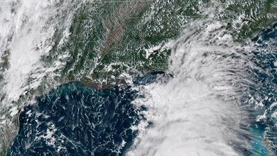
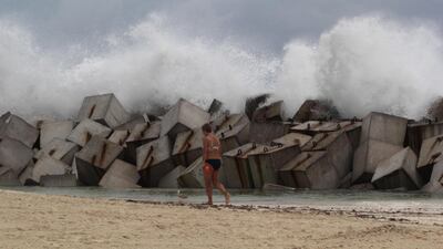
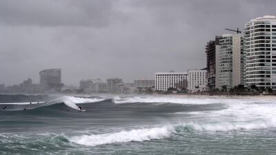
A tropical weather system that rapidly strengthened into Hurricane Michael on Monday is likely to keep growing stronger ahead of an expected strike on Florida by midweek.
Michael could strengthen into a major hurricane with winds topping 178kph by Tuesday night before striking Wednesday on the Panhandle or Big Bend, according to the National Hurricane Center.
UAE citizens in Florida were advised by the UAE consulate in New York to be prepared for evacuation procedures as the storm approaches.
Since the storm will spend two to three days over the Gulf of Mexico, which has very warm water temperatures and favourable atmospheric conditions, "there is a real possibility that Michael will strengthen to a major hurricane before landfall," Robbie Berg, a hurricane specialist at the Miami-based storm forecasting hub, wrote in an advisory.
Energy companies on Monday halted nearly a fifth of Gulf of Mexico oil production and evacuated staff from 13 platforms as the storm intensified and headed for a path up the eastern US Gulf.
Offshore producers including Anadarko Petroleum, BHP Billiton, BP and Chevron Corp evacuated workers from oil and gas platforms in the Gulf.
Michael's large size, strong winds and heavy rains could produce hazardous flooding along a stretch of Florida's Gulf coast with many rivers and estuaries where seawater pushed ashore by a hurricane could get trapped. "This is a part of the Gulf of Mexico that is incredibly vulnerable to storm surge," Hurricane Center Director Ken Graham said.
Parts of Florida's curvy Big Bend could see up to 3.5 metres of storm surge, while Michael also could dump up to 30cm of rain over some Panhandle communities as it moves inland.
Mandatory evacuation orders were issued for residents of barrier islands, mobile homes and low-lying coastal areas in Gulf, Wakulla and Bay counties.
In a Facebook post on Monday, the Wakulla County Sheriff's Office said no shelters would be open because they were rated safe only for hurricanes with top sustained winds below 178 kph. With Michael's winds projected to be even stronger than that, residents were urged to evacuate inland.
"This storm has the potential to be a historic storm, please take heed," the sheriff's office said in the post.
A large mound of sand in Tallahassee was whittled down to a small pile within hours Monday as residents filled sandbags to prepare for potential flooding. A couple of breweries in the city offered free filtered water to anyone bringing in containers.
"All indications are that it's going to be severe," said city commissioner Gil Ziffer, adding that if the storm hits Florida's capital, there would be significant tree damage and power outages. "Hopefully, we will have no one hurt and no loss of life."
Two years ago, Hurricane Hermine knocked out power for days in Tallahassee and caused widespread flooding as it came up through the Gulf Coast. Ann Beaver was among the three-quarters of city residents who lost power after that storm. She was preparing for a similar experience on Monday.
"I don't want to lose everything in the freezer, but it is what is," said Ms Beaver as she loaded sandbags into her family's pickup truck.
Tallahassee Mayor Andrew Gillum, who is the Democratic nominee for governor, had planned to campaign in South Florida on Monday and Tuesday, but he said he would return to the city to help with storm preparations.
Florida State University and Leon County schools canceled classes from Tuesday through Friday.
Further west along Florida's Panhandle, the city of Pensacola tweeted to residents: "Be sure you have your emergency plan in place."
By 2pm on Monday, Michael's top sustained winds were around 120 kph.
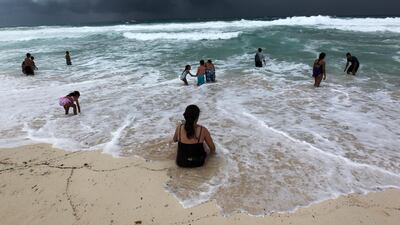
The storm was centred about 30km off the western tip of Cuba and about 230km east-northeast of Cozumel, Mexico. Hurricane-force winds extend outward up to 45km from the storm's centre and tropical-storm-force winds extend outward up to 280km.
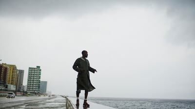
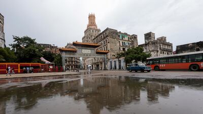
Michael was lashing western Cuba late Monday morning with heavy rains and strong winds, according to the hurricane centre. Forecasters warned that the storm could produce up to 30cm of rain in western Cuba, potentially triggering flash floods and mudslides in mountainous areas.
Florida governor Rick Scott issued an order for a state of emergency for 35 counties, from the Panhandle through to Tampa Bay, to rush preparations, freeing up resources and activating 500 members of the Florida National Guard.
Aside from causing power outages, flooding and property damage, Michael could also worsen a toxic algae bloom that has plagued Florida's beaches for a year.
The red tide in the Gulf of Mexico off southwest Florida that began last October after Hurricane Irma swept up the state has killed massive amounts of marine life and caused respiratory irritations in people. The bloom has spread to Florida's Panhandle and the Miami area.
Tracy Fanara at Mote Marine Laboratory and Aquarium in Sarasota said the algae are "very vulnerable to turbulence" and the bloom could dissipate. However, Ms Fanara said, Michael's strong winds also could stir up pollution and nutrients in the water that feed algae blooms.
Michael was expected to make landfall Wednesday in parts of the Panhandle where county jail inmates were enlisted last week to help clean up fish killed by the red tide.
