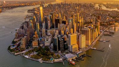
Home to some of the world’s most-visited destinations, including Wall Street, the 9/11 Memorial site and the Staten Island Ferry dock, New York’s Lower Manhattan is gearing up for a multi-billion-dollar makeover at the hands of Mayor Bill de Blasio.
In a bid to combat the threat of climate change, the New York mayor has announced plans for an extension of the coastline between Brooklyn Bridge and the Battery into the East River.
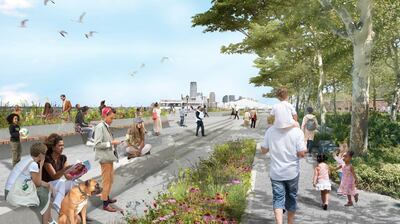
The 150-metre extension, about the equivalent of two full city blocks, will create a new piece of land with high points lying about six metres above current sea levels. This new patch of land will act as a storm barrier. It will also protect nearby neighbourhoods, like the historic South Street seaport and its restored 19th-century buildings, against projected sea-level rises.
Details for the development were released this week by the New York City Economic Development Corporation (NYCEDC). The Lower Manhattan Climate Resilience study outlines a list of long-term and temporary measures designed to protect Lower Manhattan from climate change.
City officials have been working on the plans since Hurricane Sandy destroyed huge parts of the city in 2012.

As the cradle of New York, Lower Manhattan is home to towering skyscrapers, Wall Street, the New York Stock Exchange and countless historical landmarks, all of which create unique challenges when it comes to development. Low-lying topography, an active waterfront, lack of space and dense infrastructure both above and below ground mean flood-risk development will not come cheap.
When finalised, the project as a whole will aim to protect 70 per cent of the city at a cost of approximately $500 million (Dh1.84 billion). Mayor Blasio has said plans will go ahead even if federal funds are not available.
Preventing 'cataclysmic' effects of global warming
In a statement released by NYCEDC, the mayor commented on the vulnerability of Lower Manhattan, saying: “We not only have to reduce emissions to prevent the most cataclysmic potential effects of global warming, we have to prepare for the ones that are already inevitable.” He added: “Our actions will protect Lower Manhattan into the next century.”
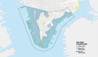
The study projects that by the 2050s, 37 per cent of Lower Manhattan will be at risk from storm surge, while 50 per cent of properties will also be at risk. By 2100, rising sea levels would expose 20 per cent of the lower borough to marine flooding.
According to States at Risk – an organisation set up to predict climate change impact in the United States – New York City currently has 431,000 people at risk of coastal flooding. By 2050, this is projected to grow to 228,000 due to rising sea levels. And that’s not even taking the 13.67 million tourists that the city receives each year into consideration.
As one of the most-visited cities on the planet, New York will also implement a series of temporary measures to protect against the upcoming flood season. These will include barriers, flood walls and dams in South Street, the Financial District and the Two Bridges neighbourhoods.
Battery Park City will also being plans to reconstruct its esplanade and open space with construction due to start in 2020.


