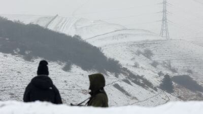
Large parts of England were expected to experience severe snowstorms on Thursday following the coldest March temperature in more than a decade being recorded overnight.
The Met Office has issued two amber warnings, one for "strong winds bringing blizzard conditions" and the other for snow and ice. The alerts cover a vast area of the country and significant transport and power disruption is expected.
With the potential for up to 40cm of snow in some areas, the heavy snowfall and blizzard conditions could damage infrastructure and affect communication lines, leading to phone network disruption.
Warnings have been issued as rural communities are being cut off and heavy snow has led to the closure of nearly 300 schools in Wales.
The Met Office says there is a likelihood of significant disruption to phone and mobile network coverage due to the severe snowstorms and high winds expected on Thursday.
The amber snow warning for England covers major cities, while the snow and ice warning over Wales extends from noon on Thursday until 9am on Friday. The turbulent weather stems from an Arctic air mass from the north and mild air from the south converging over central areas.
Amber warnings indicate that severe weather is likely to cause disruption to travel, such as delays, road and rail closures, and power cuts.
Additionally, there is a potential danger to life and property. It is recommended that people consider changing their plans and take preventive measures to minimise the effect of severe weather on themselves and their property, the Met Office has warned.
Meanwhile, six people have been rescued from a mountain in Co Kerry in dangerous conditions as a snow warning has been put in place for the whole of Ireland. Kerry Mountain Rescue Team responded to reports of a female hillwalker who had fallen in the MacGillycuddy's Reeks and later found six people stuck 150 metres from the bottom of a gully.
This weekend, the UK faces a return to wintry conditions as areas of low pressure that brought milder air move east, with northern Scotland and the east coast of northern England likely to be worst affected.
Friday night is set to be cold, with a clear and frosty start to Saturday for many.
On Saturday, another area of low pressure will arrive in the west, with uncertain progress eastwards. This will bring a band of rain that may turn occasionally to sleet and snow, most likely on high ground across northern England and Scotland.
Moving into next week, low pressure from the west will bring strong winds and heavy rain across southern areas of the UK, with up to 40-60mm of rain possible in 48 hours, mainly across western areas.
However, colder air is expected to persist in northern Scotland, where temperatures will be lower and winds less strong.
Snow blankets the UK — in pictures
The UK Health and Security Agency has issued a level-three cold weather alert for the whole of England. People have been urged to check on vulnerable relatives and take steps to prepare for travel disruption.


