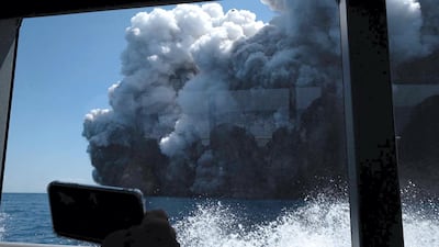
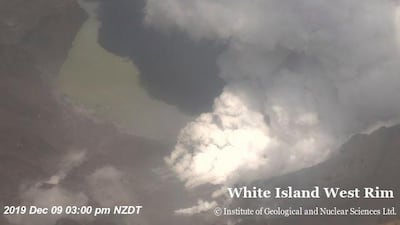
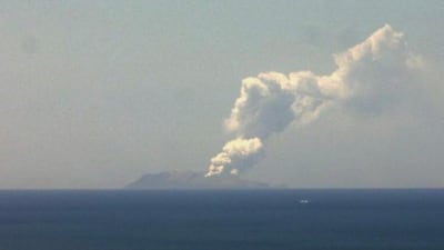
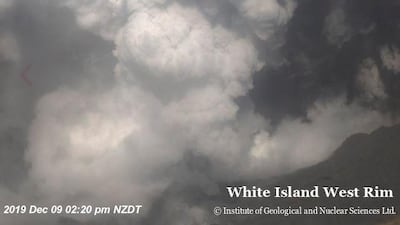
New Zealand's White Island volcano erupted on Monday, spewing a plume of ash kilometres into the air.
At least five people were killed and several others injured, as the Pacific country mounted a rescue effort to save tourists trapped on the island.
Twenty-three people, some of them believed to be tourists from the Ovation of the Seas cruise ship, were rescued, police said.
How did the eruption happen?
The volcano erupted at about 2:11pm local time (1.11am GMT / 5.11am UAE), throwing an ash plume about 3.6 kilometres into the air, government agency GeoNet said. The plume was visible from the mainland of New Zealand's North Island.
New Zealand's geoscience agency GNS Science said it was a "short-lived eruption" and there were no current signs of an escalation.
However, GNS Science volcanologist Brad Scott said the eruption was significant and had affected the whole of the White Island crater floor.
The GeoNet agency at first raised its alert level to four, on a scale where five represents a major eruption. It later dropped the alert level back down to three.
Mr Scott said that was because the eruption wasn't sustained beyond the initial blast.
Should tourists have been on the island?
Questions will be asked as to why tourists were still able to visit the island after scientists recently noted an uptick in volcanic activity.
GeoNet raised the alert level on White Island from one to two on November 18, noting an increase in the amount of sulfur dioxide gas, which originates from magma deep in the volcano. It also said at the time that over the previous weeks, the volcanic tremor had increased from weak to moderate strength.
Mr Scott said the alert level was often raised and then later dropped again without any eruption. He said there hadn't been any major incidents with tourists visiting the island in the past, although there had been some close calls.
Mr Scott said it was not for him to say whether the island was safe enough to host tourists immediately before Monday's eruption.
How active is the White Island volcano?
One of New Zealand's most active volcanoes, White Island sits about 50 km from the east coast of the town of Tauranga on the country's North Island.
GeoNet said it is New Zealand’s most active cone volcano and about 70 per cent of the volcano is under the sea. It has erupted frequently over the last 50 years, most recently in 2016.
In August of that year the New Zealand Defence Force airlifted a 2.4-tonne shipping container onto the island to serve as an emergency shelter in case of an eruption.
Twelve people were killed on the island in 1914 when it was being mined for sulfur. Part of a crater wall collapsed and a landslide destroyed the miners' village and the mine itself.
Buildings from another mining enterprise in the 1920s are now a tourist attraction, according to GeoNet.
The island became a private scenic reserve in 1953, and daily tours allow more than 10,000 people to visit the volcano every year.
The island is also known by the indigenous Maori name Whakaari.
Will White Island erupt again?
There have been no further signs that volcanic activity will escalate in the immediate future.
“We have seen a steady decline in activity since the eruption,” Geoff Kilgour, duty volcanologist at GeoNet, said. “There remains significant uncertainty as to future changes but currently, there are no signs of escalation.”
What is the Pacific Ring of Fire?
New Zealand sits on the Pacific Ring of Fire - also known as the Rim of Fire - a belt of volcanic and seismic activity that surrounds the Pacific Ocean.
The ring forms an arc from south of New Zealand through South-East and East Asia then down along the west coast of the Americas all the way to Chile.
With more than 450 volcanoes, the vast majority of the world's largest volcanic eruptions in recent history have occurred within the Ring of Fire. Likewise, it has also been the site of the majority of the world's earthquakes.
The activity is the result of the movement of tectonic plates - the large masses that form outermost shell of planet Earth, which sits just under the crust which forms oceans and continents.
How do volcanoes erupt?
Molten rocks from deep within the earth known as "magma" rises and collects in chambers below the Earth's surface, where it can eventually erupt and form a volcano.
Volcanoes usually form where tectonic plates collide or are pulled apart.
There are different kinds of volcanoes. Some, such as those in Hawaii, have runnier magma which tends to escape in slow-moving lava flows, while others have thicker magma with a large amount of gas.
The latter can produce more powerful, explosive eruptions. Explosive volcanoes can send ash clouds several kilometres into the sky.
Timeline: Previous volcanic eruptions in New Zealand
1914: The White Island volcano's last fatal eruption kills 10 sulphur miners.
August 1938: The White Island volcano erupts in the Bay of Plenty off North Island.
1953: An eruption at Mount Ruapehu on North Island wrecks a railway bridge just before the arrival of a Wellington-Auckland express train, plunging it into a river and killing more than 150.
February 20, 1992: The White Island volcano, then termed New Zealand's most active, spews a huge column of grey ash as scientists prepare to venture into its crater on a routine study.
September-October 1995: Mount Ruapehu erupts in several bursts, sending clouds of ash 10,000 metres into the air.
Three volcanic peaks in the central part of the North Island, Mount Ruapehu, Mt Ngauruhoe and Mt Tongariro, form the southern tip of the Pacific Rim of Fire, an arc of active volcanoes around the Pacific Ocean.
June-July 1996: Mount Ruapehu erupts, belching glowing car-sized boulders and disrupting air traffic.
Mar. 2006: Volcanic eruption on remote Raoul Island, part of a nature reserve in the Kermadec group, causes plume of steam and ash, besides spewing mud from a lake. The island is 1,000km northeast of New Zealand.
March 18, 2007: The volcanic crater lake at Mt Ruapehu bursts its banks, sending a mudflow toward the rural community of Tangiwai.
August 2012: Mt. Tongariro, dormant for more than a century, spews boulders and spreads an ash cloud as it explodes with bright flashes and thunderous booms.


